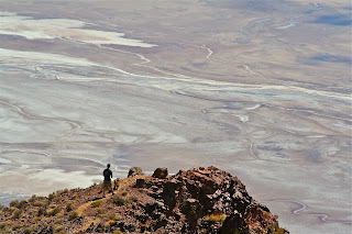
... viewing north into the 'Badwater Basin' and 'Death Valley', which stretches for 130 miles to the north and south - that's California highway Rt 178 far below...
... from the parking area several trails travel north and south, each
about a 1/2 mile "out and back" - above, the southern trail, with 'buddy Matt' and 'Desert Dog Koda' for scale...
... viewing south...
... excavate all the gravel from the valley floor - eroded for eons from the mountains above - and the valley bottom would be another 5000 to 8000 feet lower...
... Matt and Koda "on top of the world"...
... northern backtrack and the 'Black Mountains'...
... 'Panamint Mountain Range' to the west...
... this may be the official "Dante's View', located to the north of the prior photos - such a spectacular area throughout - if not - who cares??!!...


No comments:
Post a Comment