Sunday, January 28, 2018

Warren Miller

... freedom found...

1924 - 2018

... "when you come down the mountain from your first time on skis, you are a different person... the weariness in the mind slips away, and there's a wonderful feeling of being powered by that huge force called total freedom"...
-WM                                

Saturday, January 27, 2018

The Historic Big Inch

... never realized the historical significance of the 'Big Inch Pipeline' until just recently - bet you could ask ten out of ten people hereabouts and get the same comment... did hear a few local "old timers" refer to it as the Big Inch a time or two ("... there's a lot of rattlers along the Big Inch"), but never inquired as to why...

... travels 1400 miles from East PA to East Texas - built in 11 months (!!) in 1942 for the sole purpose of supplying oil to east coast refineries and subsequently European troops for the purpose of kicking the Nazis ass in WWII, who themselves were sinking the majority of the oil tanker shipments off the coast of Florida when rounding the Florida peninsula... goes over eight mountain ranges, under thirty rivers and hundreds of small streams - was the biggest pipeline project in the world at the time...

... heres a few informative links:


... a short informative video for those who gotta' run:


... another short construction video - not the Big Inch, but fun:


... found a few old archive photos of our own:

... bet we've climbed this section of the Big Inch at least a hundred times over the years en route to a local rock crag and boulder field - these photos are from sometime in the 90's during an upgrade - wasn't aware of the history at the time - would have liked to have gotten a souvenir hunk of the original pipe looking back on it... sat and watched an operator bring a big track backhoe down that steep slope one day (is a lot steeper than the photo suggests) - he pretty much bull-rode it down the whole distance using only his bucket to brake the machine, which slid, bucked and rocked like crazy and occasionally spun near ninety degrees the whole trip - pretty impressive handling on that guy's part...

... a bit better perspective - strongman Matt and the Big Inch about 600 feet above the Dunbar Creek valley - another day, watched that big CAT dozer (in the photo) winching another big dozer up that big slope - the operator would back up then drift forward then back up the drift forward and so on - each time stopping right at the top of the big drop on the drift - after getting the other big machine to the top he shut down and got off his big CAT - I thought he was pulling the other big machine up the big hill - he said no - the big CAT he was on didn't have any brakes(!!)... "I been tellin' 'em they need fixed"...

... a 90's Muscle Girl Sarah along this day as well - we see she has along her combination brush/briar/rattlesnake stick (for shoo'n 'em off the path) - wise gal - that's big rattler habitat up there...

... nothin' but respect for the guys and gals (recall there was a very good female welder or two on this project) who construct this stuff - Good Work!!...

Saturday, January 20, 2018

The Big Inch

... have for many years occasionally "rolled the grapes" over a local natural gas pipeline ('The Big Inch'), aligned thru some pretty rugged terrain, with thoughts of the practicality of a ski tour - did a few recon trips on foot as well as frequently hiking a particularly steep section when accessing a favorite rock climbing crag - always considered the steep slopes as a bit too much to tackle considering the capability of the light nordic XC skis of the time, and filed the idea away as something that may be fun some day with the right equipment and snow conditions...

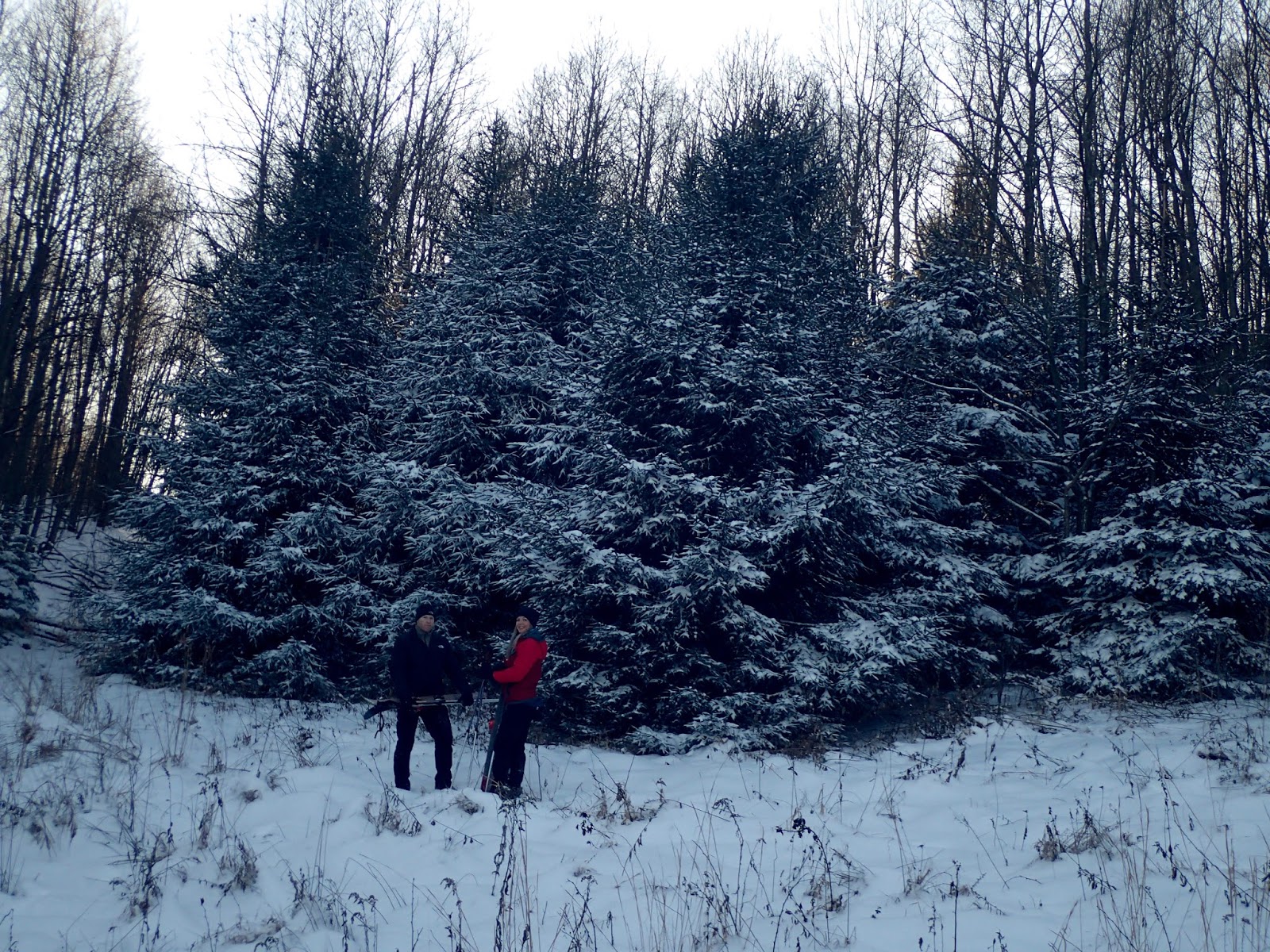
... hey - those backcountry ski boards we been playin' around on for the past ten years are really responsive, adapt well to the dense woods hereabout, and the built-in climbing skins climb extremely well compared to the positrack base available on standard touring skis - the route we had in mind was gonna' include a lot of steep up, and down... and nothin' better in mind come Sunday...

... on top of that, these two guys are up for anything cold and tough (= fun)... above - venturing south and close to a mile and three-quarter from the trailhead (elevation = 0ft) and around 525ft of elevation veer east and continue along this steep trail...

... with steep climbing...

... two miles out you can take a short diversion and check out these very cool rock formations at around 680ft elevation...

... lots of big boulders...

... separated by a maze of narrow corridors...

... lots of bouldering potential - we put up quite a few routes years back - not much easy access (walk up) to the top of most of the blocks and a forest of rhododendron hence...

... one long corridor in particular is very cool...

... sports a wall of these giant roots that we discussed early on in another topic...

... then pinches to narrow, near shoulder width at length...

... leaving the boulders, another mile through woods and fields gets ya' to intersection with the 'Big Inch' and open blue sky at highpoint 800ft elevation - think it never got to above 15º(F) this day - never felt below freezing...

... viewing due west - as expected, appears to be a tough one mile between here and return to the trailhead - what we came for...

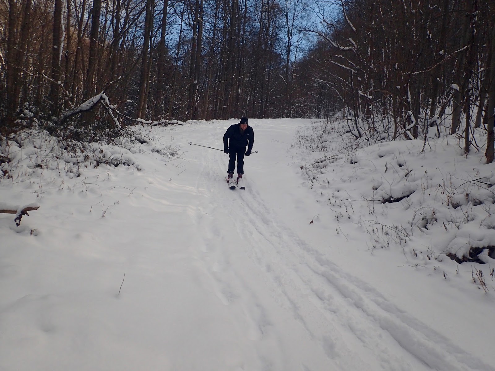
... some gliding terrain finally - this was actually a pretty nice downhill - a bit slower on the skiboards - those buit-in climbing skins slow ya' down a bit on the downhill slopes - but that's OK...

... another steep 40ft of climbing...

... got shut down on this first big downslope (240ft drop in 0.2 miles per topo mapping) - what we expected to be the crux of the trip (wasn't to be) - the entire slope was covered with an impenetrable forest of greenbriars with thorns the size of daggers - we had to ditch the boards and bushwack the equally steep forested sideslope (and more greenbriars)...

... hopping the small tributary stream at the bottom of the gully - viewing ahead to another 0.4 miles and a rolling 330ft of climbing to the top of the distant ridgeline...

... opted to continue on foot over this section as well - didn't matter one way or the other...

... viewing back due east ridgeline to ridgeline...

... encountered this very nice large stand of hemlocks...

... a bit more distance of climbing then it's all an easy, albeit steep, downhill dropping a big 620ft in 0.4 miles and return to the vehicle...

... which was not to be - the west facing slope of the pipeline was again covered with a sea of dagger greenbriars - we opted to travel the adjacent old construction road which turned out to be the crux of the trip - many large fallen trees blocking the upper very steep and washed 0.2 mile...

... with very steep, washed and rocky open skiing in the remainder - lots of sidestepping and a few pretty good wipeouts by all when surprised by unseen shallow snow covered rocks or swept down into deep ruts - this photo does no justice at all to the angle of slope or conditions...

... altogether, a great (albeit tough) trip - minus the greenbriars, would be highly recommended with another one (good) to two (best) feet of snow cover - those skiboards are a wide 100mm to 110mm under foot and a bit tough to set on  edge in shallow snow conditions (was probably four to six inches cover this day) - but still, after today consider them made for this kind of stuff - they took a heck of a beating in that final half mile - wouldn't recommend driving them with anything but stiff touring boots as well (we fit 'em with three-pin Alpina Alaska 75's/Voile HD bindings which work great)...

A brief summary:
Total trip length: 4 miles
Total trip time: 5 hours (including time checking out the boulders)
Total climbing elevation: 800 feet (trailhead to highpoint)
Additional climbing elevation: 370 feet
Total climbing: 1,170 feet
Steep downhill: (between >30º to <50º) 860 feet
Wipeouts (in 0.4 miles): 12 (a guess, between the three of us)
Fun: 5 out of 5

Saturday, January 13, 2018

Kentuck

... final day of a great two week run of below freezing temperatures and powder snow - thee days later (unfortunately) was 64º(F) around here... hit up the Kentuck ski area at Ohiopyle SP...

... around 25º(F) and sunny skies...

... could have used a bit more snow but not bad - varied around four to six inches and still powder...

... a nice long downhill or two up there - this is the best one -  continues well beyond that distant bend...

... fast and lots of fun...

... an intersecting trail loops back around with a nice long hillclimb...

... gets ya' back to the top and another run if ya' want...

... alternately some great rolling terrain thru the woods...

... and open meadows...

... some fast moving...

... they got one fun trail along the wooded hillside that we remember used to be rated a "black diamond" years ago (the sign is gone now) - had a few downed trees across it this day and appears seldom used (and unfortunately not maintained) - a snaking drop or two and a few fast winding bends along it - not bad though...

... noticeable difference on the modern BC 110's with sidecut and metal edges driven with some stiff three pin boots compared to the old straight cut nordic kickers and soft boots (still - and although he denies it - we suspect this guy's been on skis before - skis too well to not have)...

... other than lots of deer prints the whole area was untracked - steady movin' for close to three hours today - we'll figure a conservative four miles of travel...

Saturday, January 6, 2018

Season of the Soul

... completed the trifecta with a New Years Day out and back...

... over the ridge and thru the woods...

... pretty brutal when out of the wind break of the forest - takin' a break here to enjoy the balmy -22º (F) wind gusts - another great day...

...The Cosmic Spirit seeks not to restrain us
But lifts us stage by stage to wider spaces...

- Herman Hesse, 'Stages'                                             

Monday, January 1, 2018

Eleven Hundred Foot Day

... taking further advantage of the lingering powder snow conditions we've been gifted with...

... headed out again on Sunday with Muscle Girl Sarah and ZMan - shuttled some vehicles and bypassed the long climb in this time and took the shorter quarter mile approach across the top of the ridge...

... and headed directly to the two miles of downhill...

... still some great powder happenin'...

... cruising on the 110's - some fast moving in yesterdays tracks - another inch of overnight powder didn't hurt either...

... after a mile of the steeps decided to take a detour over to an adjacent knobby ridge...

... a half mile of steep climbing gets ya' to the top...

... and some even better downhill on the return...

... three hundred foot drop from top to bottom...

... with some fast gliding...

... ZMan first time ever on the backcountry boards showing some nice natural parallel technique...

... did very well...

... Sarah rounding the bends and showing some pretty good natural telemark technique in the above sequence of images - not bad...

... ZMan good control with the parallel...

... nearing the final turn and bottom of the run...

... good work...

... final mile and return to the trailhead...

... takin' a short break at this small rock overlook to warm up the fingers in the late afternoon sun - don't think it got above eight degrees all day - was a rough day on the digits...

... short trip distance wise - around four miles - with a little over a half mile of steep climbing and eleven hundred feet of total drop... not bad.. 

... hey, we're not out west nor up in New England, but not bad for SWPA...