Sunday, September 20, 2015

Red Rock Canyon, NV - Willow Springs and Pine Creek Canyon

... a couple more 'Red Rock Canyon' trails...

... nice view from the 'Willow Springs' picnic area - 'La Madre Mountain' in the distance - the 'White Rock Hills' near...

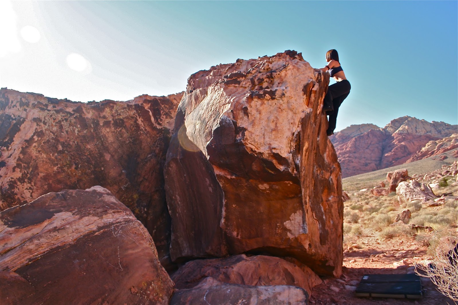
... there were a few pretty nice boulders right near the picnic area... 

... all were well "chalked up" so we figured that they must be pretty decent - had some rock shoes in the pack so we decided to mess around on a few-'buddy Matt' climbing...

... "survival" crash pad - the rental car we had was equipped with four of 'em!...

... some interesting colors to the rock...

... some decent size, too - wound up hanging out here for so long that we never checked out the intended 'White Rock Trail'...

... so we bagged that and moved a bit further down the road to check out the shorter 'Pine Creek Canyon' trail - an "out and back" about five miles in length (round trip) - about 600ft elevation gradient...

... a myriad of plant-life thrives along the trail - a 'Cholla Cactus' here - you could spend most of the day identifying all the species...

... colorful rocks abound - always like how the green lichen contrasts with the pink and red desert sandstone...

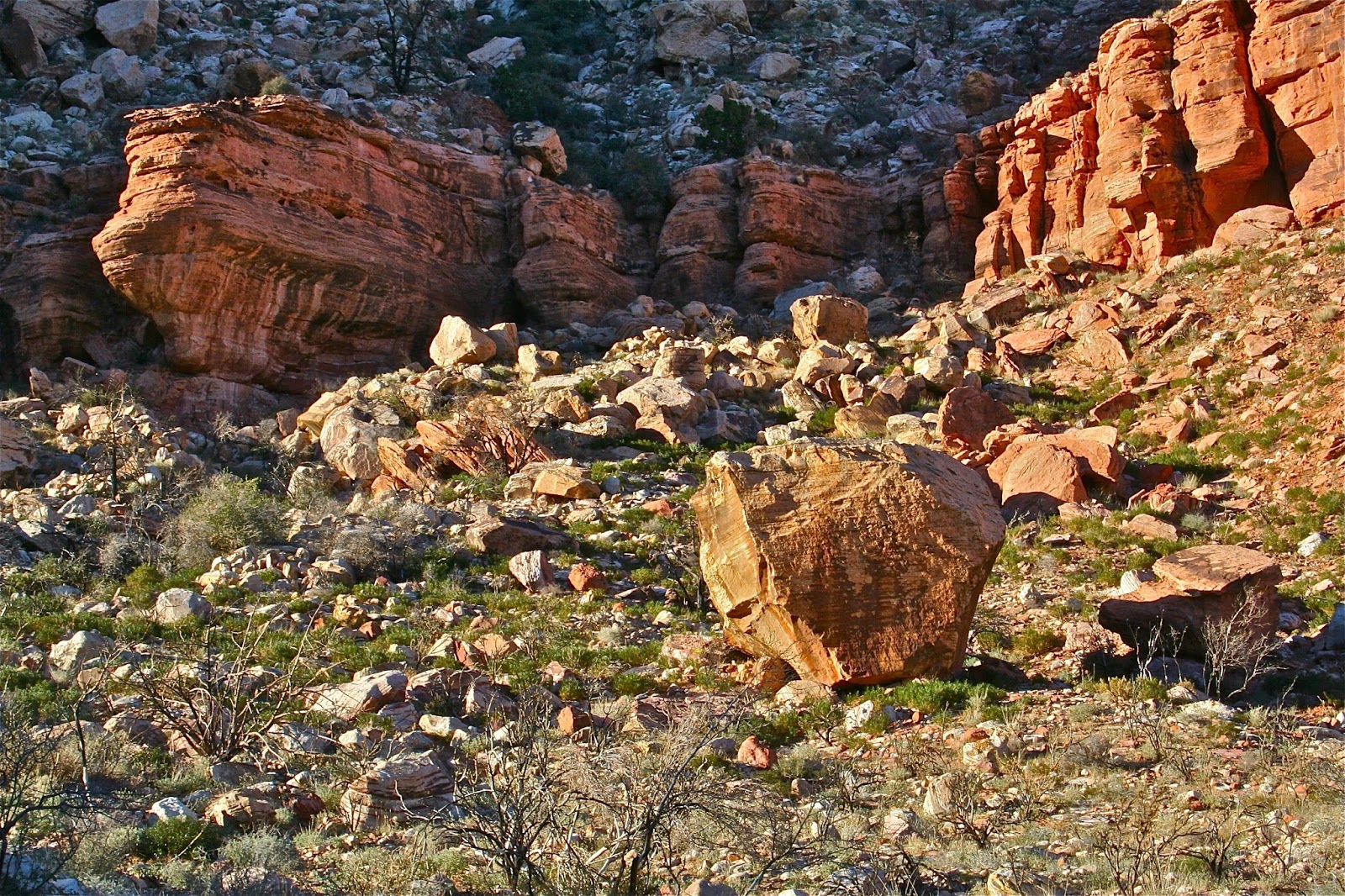
... stones everywhere...

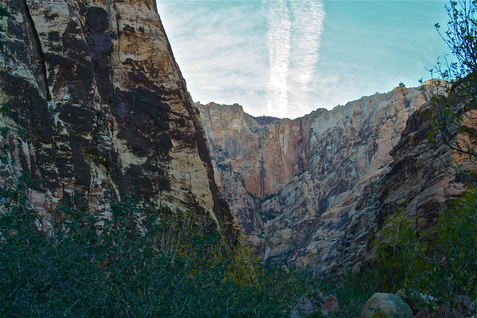
... think this formation to the north of the canyon is called 'Bridge Mountain'...

... viewing from the trail to the south - the obvious 'Rainbow Mountain' near and 'Mt. Wilson' (tallest peak in 'Red Rock Canyon') far...

... the formation 'Mescalito' splits the canyon - 'Pine Creek' to the south (left of photo) and the 'North Fork of Pine Creek' to the right...

... some large sandstone bluffs forming the north wall of the canyon...

... closer view of 'Mescalito' - if you look along the left skyline you can make out a few climbers for scale...

... beyond 'Mescalito' and some big sandstone walls forming the back side of the canyon...

Saturday, September 12, 2015

Red Rock Canyon, NV - Red Springs and Kraft Boulders

... pretty nice evening hangout when out in 'Vegas' - short drive from 'buddy Matt's' place...

... 'Red Springs' area of 'Red Rock Canyon'...

... some easy hiking a short distance from the vehicle...

... lots of rock 'scrambling' ta' do up to several hundred feet - very easy to however hard you want to scare yourself...

... roped climbing as well - a few climbers near the center of the image...

... viewing down from part way up an easy scramble - a few hikers for scale...

... and a 'trail runner'...

... a few 'Barrel Cactus'...

... lots of late afternoon and evening shade...

... just up the road ya' got the 'Kraft Boulders'...

... a new buddy we made - 'Kentucky' - providing scale to the place...

... along with great viewing...

... almost everyone living in Vegas is from somewhere else - she said that the hotel she worked at required the employees to abbreviate the name of the state they were from on their uniform nametag along with their first name  - said she got  a lot of kidding from everyone with the moniker "KY"...

... regardless - a pretty good climber...

... don't know the names given to any of the boulders - picked up a 'guide book' to the place, but don't like lookin' at those things unless looking for something specific - like to be surprised...

... pretty sure that this one...

... is called the 'Potato'...

... at least that's what this strong-ass dude from California said it was called (guess he would be called 'Cal' - which would make me 'Pa') - he was runnin' up everything in site ("warming up") before heading off up the canyon to where "they recently found some hard stuff"...

... we said that we would stick around here...

... on the "easy stuff"...

... another visit after driving over with 'buddy Matt' to hike around, after gettin' bored settin' around the house one evening...

... don't know...

... ?...

... ??...

... ???...

... ????...

... gonna' have to hike up the canyon one of these visits to check out the hard stuff he's talkin' about...

Monday, September 7, 2015

Six Mile Day

... was a bit disappointed with myself after posting 'Ten Mile Day' for ditching the camera less than half way along the "trip" - so yesterday decided to hike up to where I left off to finish the "project"...

... lookin' back upriver from near the put-in at 'Casparis Hole...

... some white 'Morning Glories' that were bloomin' along the eastern shoreline...

... large patches of 'River Grass' (for the want of a better description - have no idea of the "technical name") along the shallow, rocky shoreline inside this wide bend...

... this 'panorama' would match viewing to the right of the previous image...

... this is some of the deepest stretch of the entire gorge - nearly 1200ft below the flanking mountainsides as the river drops west of 'Chestnut Ridge'...

... kayaking 'WildBill' Fiesta appeared later in the morning - he's the small speck right at the waterline in the lower left quadrant of the image - around seven o'clock of photo center - he really adds some scale to the landscape...

... lookin' downstream from atop 'Middle Rock' of the 'Three Sisters' (there's actually four) rock formation - that's 'Whale Rock' near...

... closer view of 'Whale Rock' - there's actually a decent boulder climb starting from out of the water to the left of the obvious thin crack/flake that is pretty difficult...

... HA! - 'Muscle Girl Sarah' scratched her name into the top of 'Middle Rock' over twenty years ago - is still there - don't know what's up with the cryptic 'U' that was carved in recently...

... pretty cool how these two eastern 'tinajas' have eroded into the soft sandstone...

... sacrificial cobbles to the river gods...

... used to be a large piece of 'Petrified Wood' lodged in the soft sandstone, but someone made off with it long ago...

... this is all that's left...

... lookin' upstream from the top of 'Middle Rock' to 'First Rock'...

... a bit downstream viewing back at 'The Three Sisters' - 'Whale Rock' near and 'Middle Rock' far - luckily a few people showed up to add some scale to the image - that's them standin' on 'Middle Rock...

... a "choppy" bend - this is about as rough as the current gets...

... look at these people hangin' out and havin' fun at this small beach!...

... a large sandstone river boulder left and a large ledge of 'Loyalhanna Limestone' right - this is where the limestone dips and disappears back underground for eventually hundreds of feet...

... sandstone boulders - this photo would match viewing left of the previous image...

... more large sandstone boulders...

... final stretch before the takeout and end of trip...

... drove 'WildBill' back upriver to the put-in to get his truck - add'n a bit of easy 'Off Roading' to the day...