Sunday, January 6, 2013

The Big Loop (Mountain Biking Part 2)....

....start at the bottom of 'Casparis Hill' in South Connellsville, follow to 'Foleys Pond' - then north to 'Sandy Flats' - north/east to 'Sandy Flats Road' - east thru 'Hawkins Hollow' to Mt Tabor Road - south to 'Indian Creek' - follow Indian Creek (many swimming holes) to the Youghiogheny River - just west of the railroad trestle (bounce across the abandoned trestle for a bit of a thrill) -  wade the Yough River south to 'Camp Carmel' (< 2ft on the Ohiopyle River Gauge is best) - thru the camp (expect some hassle from the "camp counselors" - good people, none the less - if they're there - good place to refill water bottles, they have an outdoor wellhead with water faucet) - jump on the Yough River Trail (YRT) - east/south a few hundred feet to gate - right thru gate - follow long uphill - past Kraylick Rocks then flats to 'Iron Furnace' - stay right then north/west to long uphill to 'Elk Rock' - right at intersection then west to the second -  turn right to best single track downhill around (take a break to check out the Yough River overlook just before) - follow to the old 'timber mill' - stay right thru the woods - pick your way thru the single track - up hill then long downhill - when you run out of downhill, go left/south - follow to 'Cow Rock Road' ('frog pond' at intersection) - then northwest on 'Cow Rock Road' maybe 100ft - turn right (north) thru woods to steep technical downhill to YRT - then left/northwest back to ......

...e'nuff already!... about a 25 mile ride linking the east and west Yough River Gorge. Some serious elevation gain (for SWPA, maybe 1,800ft) capped by thee big hill climbs....here's a map.......


The red trail is 'main line'. Blue trails are links. Markers are just that - most are rock climbing locations.

Some photos (includes a few old prints) :  

A short, steep and technical hill climb
(Don't judge it from the photo)

(Matt)
Winter
(Howie)
Goodman
 At the time, other than a set of "wheels", didn't go much for slick or fancy outdoor gear or "threads". Wasn't a whole lot available, anyway. Let this guy get away with it, though - sort of like sporting an earring or tattoo back in the days. If you could backup your "game", no one messed with ya'.

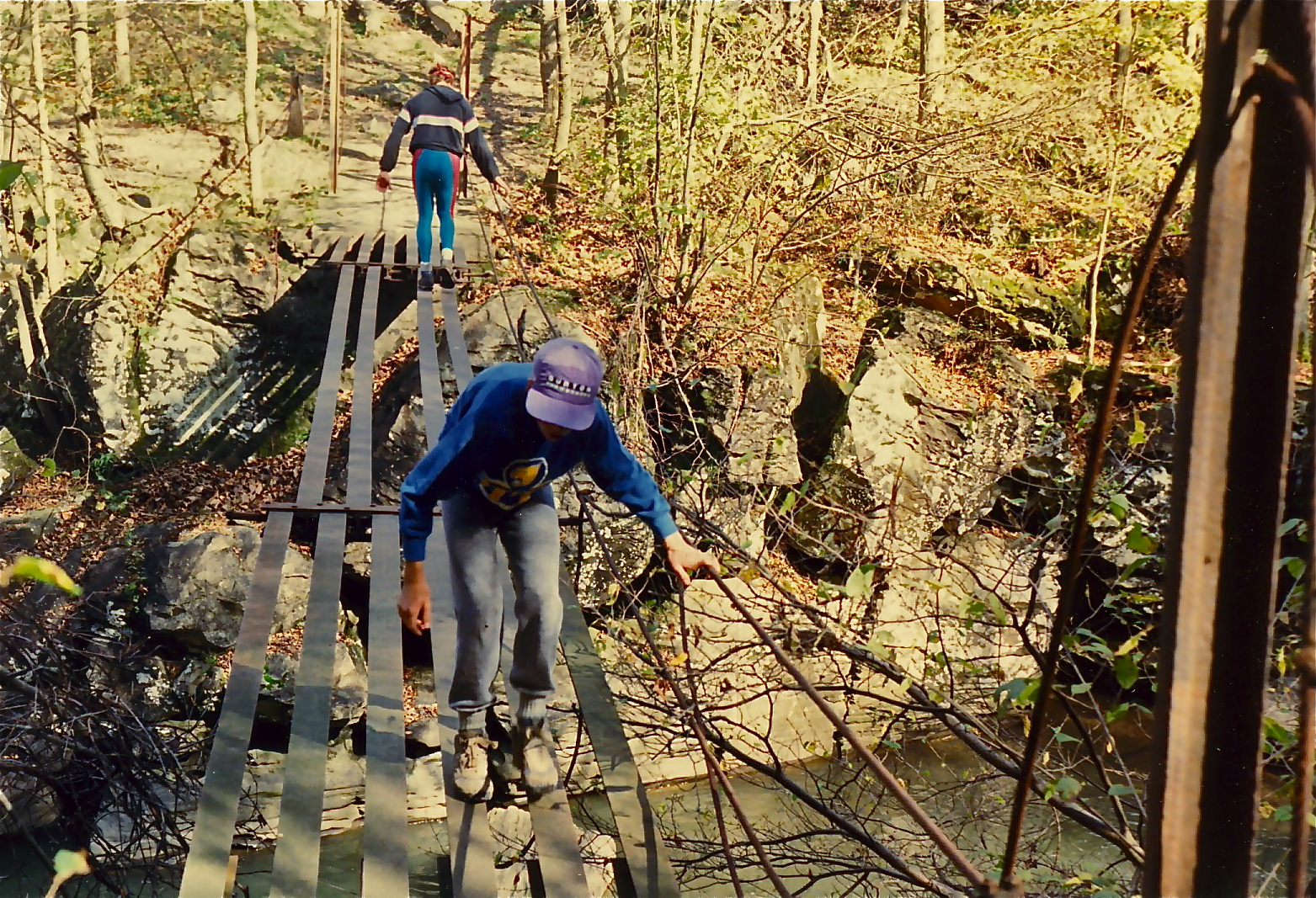
The old "footbridge" crossing Indian Creek
Just below 'Terminator' rapid

(Matt, Rob)
Overlooking the 'Yough Gorge' from the west
The 'Three Sisters' boulders seen in the river bend
'Opperman Mine' is the cliffband in the upper right
Steep single track descending from the Overlook
Doyle Tarwater riding
(Again, don't let the picture fool ya')
Some great singletrack
(Doyle again)
The 'Yough River' crossing - before departing, check the
 'Ohiopyle' river gauge if not familiar with the flow - a little
difficult if the river is staging > 2ft

(Howie and Matt)
Rob atop one of the twin 'Pillars of
Hercules' at the 'Yough Gorge Crag' -
The 'Yough River' far below
Rob takin' a break at 'Kraylick Rocks'
Pretty much of everything on this ride and lots to view - giant boulders, cliff overlooks, waterfalls.... Watch out for timber rattlers and copperheads - and baby black bears during the season - ran into an angry mother once - and no matter what ya' think, mom isn't far away (and watching). Limited to the summer months because of the river crossing. Plenty of alternatives, regardless (see map). Would plan on at least a eight hour trip. You can leave a vehicle (or start from) the Yough River Trail parking in Connellsville or near the 'Wheeler Bottom' water plant as an alternative. Never tried to reverse the trail, and wouldn't want to attempt it - a few of the drops are steep and pretty technical and are not negotiable on return, unless on foot. Pays to be in top shape, as well. Took a small group of "experienced adventure racers" along once or twice and totally fried 'em (with lots of wipeouts on the slick, slippery rocks and fallen limbs - "f*k this" was a frequent comment). Personally haven't made the complete trip since probably 2000 (used to crank it 2-3 times a season), so no guarantees. I'm told that Indian Creek is now off limits with security patrols - someone is now running a campground up there - thats all I know of that. See the 'blue trail' on the map for a "bypass" (another steep downhill) that will take you to the lower section of the creek.

More to follow....


Sunday, December 30, 2012

Backcountry (Mountain Biking Part 1)

The film soon to be added to the website. Backcountry was filmed over a two year period spanning Fall of 1997 and Fall 1998, with production completed around the end of 1998. Images were photographed entirely on Kodak 7246 16mm color negative motion picture film. Film processing was performed by Colorlab located in Rockville, Maryland. All post production was performed digitally "in house". Filming was all MOS, with all sound later dubbed. Music was from various tracks obtained from the bluegrass guitar legend, Dan Crary*(see below).  Total running time is slightly under 27 minutes at a final shooting ratio of around 2.5:1.

Casparis Overlook and Youghiogheny River far below.


We had been mountain biking for a little over ten years - pretty much since the inception of the "sport" - or at least since the beginning of commercially available production "mountain bikes" (at least around here). Had a small group of local hard-core guys  - Rob Goodman, Howie Stock, Matt Burnsworth heading up the core. Had the mountains pretty much all to ourselves and developed many tough and technical trail rides, mostly linking the developed (and endless) logging and four wheeler trails with a lot of single track throughout the woods. The best trails (stay tuned, more to come) were circuitous loops ranging from six to thirty-two miles in length - no (or little) backtracking involved. All were characterized by elevation gains (mostly steep, slow and technical) of eight hundred to two thousand feet followed by quicker descents of the same. If you averaged over three to six miles per hour at the end of a ride, you were on an "easy" trail.

At the time, didn't know how much longer we would be doing this stuff. The mountain biking here in SWPA is definitely five star - some of the best in the East (if you are willing to seek it out). Considering the film and photography background and experience involved, it was decided to at least document a bit of this activity (climbing, caving, biking....) through a series of short films - no one else was doing it. Backcountry was our second "feature".

The original concept of the film was to have a lone individual on a surrealistic ride throughout the SWPA backwoods, transitioning between the four seasons of the year. We began filming in the Fall of 1997. Soon realizing the time, effort and logistics of our undertaking, we stuck with Plan B - stick to the Fall. Rob Goodman portrayed the 'biker' throughout the film, riding an original Colorado-based Boulder Bicycles full suspension model mountain bike - one of the first commercially available. Rob was a pretty intense individual and all-around expert rock climber, skier, caver, mountain biker as well as a savvy woodsman - quitting wasn't part of his vocabulary -  no doubt he would stick around for the long haul. The scenes throughout the film are essentially a montage of images photographed from various locations along the many trails as aforementioned, all located in SWPA. Most of the areas will be immediately recognizable to "local folks". The film also includes probably the only "moving picture" images of the 'Casparis Mine' opening now in existence. The entrance to the mine was closed several years back for "safety concerns".....

Howie, Rob, Matt (probably 1994) - three of the best
....speaking  of which...no concerns with the three guys pictured above - all three could handle any situation. Unexpected problems only made it more challenging and fun. Probably made every bike repair you could think of while deep in the woods and far from the "trailhead"...from flat tires to bottom brackets to wheel axles to headsets (no sealed bearings back then)...lots of improvisation as well..."inflating" flat tires with leaf and grass, shortening broken chains for "single-speed" travel, replacing clusters of broken spokes and tuning wheels "in the field"...if these guys had a minimum of a knife, duct tape and wire ties aboard, they were riding.

Backcountry will be online within the next two weeks.

*A short disclaimer: The video is not available for sale or rental, and is intended for Internet viewing only. Reason being, we never obtained permission from Mr. Crary or his associates for the use of his excellent music, which we have long been a fan. No canned or 'Royalty-Free' libraries available back then. Wouldn't replace the tracks, anyway - there's nothing better. If it suddenly disappears from view, you know why. At best, those not familiar with his music will be "turned-on" to something new, and pick up a CD.



Sunday, December 2, 2012

Muscle Girls

Here's some photos of buddy Sarah back in action. This time from another NPC event from back in October. She's a real 'meathead' as well - sent us some workout video - 225lb deadlift, chin-ups totin' an extra 70lbs... Unfortunately, had problems formatting them into the system - were recorded on a cell phone. She promised to send some newer, more compatible stuff - stay tuned.


Posing with the evening champ - we agree

Lots of hard work on display - good job gals

Some big goon makin' his move
Didn't have the names of the other ladies available - we apologize. If your tuned in, post up.
Photos courtesy of Shawn Zagorce - thanks buddy.

Saturday, December 1, 2012

A Matter of Perspective

Around 1990, working my "real job", I was on assignment in St. Gedeon, Quebec, Canada doing some work for Canam Steel at their home plant. I was there for a little over a week, during which time they housed me in a pretty nice country inn - the 'Benedict Arnold' (he's a star in that part of the continent - that's OK, there's heroes on both sides of every conflict). The inn was very near the plant, there was a very good steakhouse/restaurant/bar located within, and they assigned a local engineer to work with me directly throughout my stay - was no need for me to have a rental car of my own. One evening after dinner I was looking for something to do. Roger (the engineer) had headed home, so if I wanted to venture very far, I was "hoofing it". St. Gedeon is a small town with not a whole lot within walking distance of the inn. There was a small antique shop across the street - figured I would walk over and pick up a gift to take back home to my Mom.

The shop was owned and operated by a little old lady. We were the only two in the shop. Everything in the shop had been hand crafted by her - paintings, pottery, figurines - all a work of art. We got to talking - asked her where she developed her talent. Found out that she had been imprisoned at Auschwitz prison camp as a young girl. The only one of her family to have survived. Showed me her identification number still tattooed on her arm. Said that she would gather whatever she could -  sticks, stones, grass - anything - and fashion small sculptures - mostly of animals, which she observed around the camp and loved. She showed me a few of the originals that she still had in the shop. Luckily, she let me purchase one. It is a small figurine crafted from a cobble, twig, stick and grass. Depicts a small yellow bird dropping her eggs to a squirrel who is carrying them off to safety. All of her little sculptures had something to do with survival.

Squirrel rescuing the eggs of the small yellow bird
There was a small birds nest with one or two eggs located
on the limb next to the bird - they must have fallen off at
some time and were lost - wish they were still there.
They say that death begins in the eyes. Lookin' at this lady as she spoke, I could tell that she had died a long time ago. I like to look at that little sculpture from time to time, and think of it when things get tough, or worse, when I or others around me begin to take all this meaningless climbing, paddling, etc.. a little too serious.

Sunday, November 18, 2012

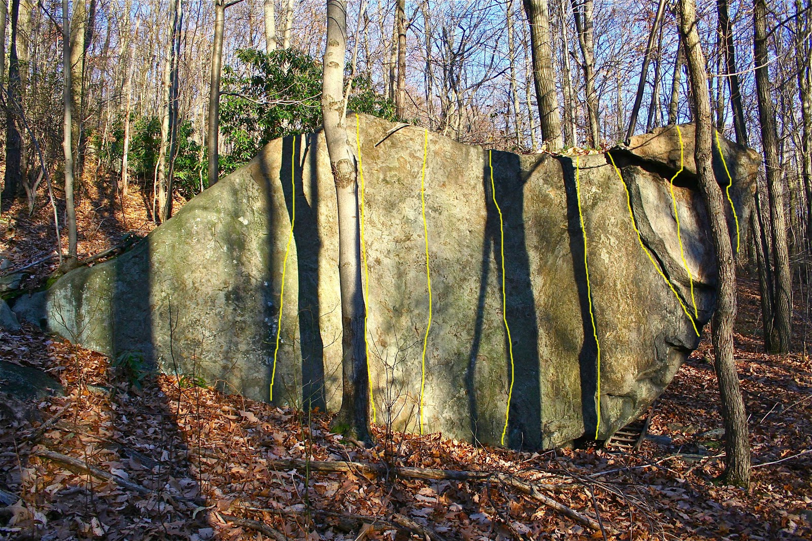
The 'Workout Boulder' (aka: 'Rat Block')

Had been climbing for about a year and reached a pinnacle - around 6'-1" tall and maybe 210 pounds light (down from a 240 pound weightlifter) - stuck at 5.8 ability, at best. Fumbled on my own for the first six months 'till I "got around". Been climbing with "hard-ass" Rob Goodman for the past six months. Goin' to 'High Rocks' in Derry, PA about every weekend. Robs got the whole place wired and really workin' me out. Example: He climbs 'Mysticism' routinely on lead, places two cams, three at best, then downclimbs and cleans the route - I'm spending hours belaying between fallin' off the same old holds week after week. Rob jackin' me to no end.  OK - thats what I'm used to from all the gym time from the ironman days. I'm reading every issue of 'Climbing' magazine and the like that I can get my hands on - what's this BOULDERING I'm reading about? Screw this weekend roped stuff - I'm living minutes from some of the best bouldering around (didn't know it at the time). Head up into the Casparis area of South Connellsville (my back yard). A few weeks of hard bouldering (un-beknownst to Rob) and I'm suddenly crankin' High Rocks - from the walls to the boulder problems. Rob's startin' to take me serious.

We routinely climbed a short High Rocks classic called 'Jimi Hendrix', rated 5.10 (a boulder problem now'days) in the old EB climbing shoes. In short time, a Spanish company, Boreal, comes out with a new shoe with vastly improved cohesive "sticky" rubber - 'Fires' (Fee-Rays, phonetically speaking). The great climber, and Rob's hero, John Bachar, is the poster boy for the shoe. First tried them out at Seneca Rocks (got the first pairs at the 'Gendarme' climbing shop) and was impressed - stemmed/edged the whole way up 'Greenwall' (a moderate 5.6) with ease - no kidding - felt at least two grades easier sans EB's.

Later on, we're back at Hendrix. Good test for the Fires. Steep thin slab. I tried to do a direct route - the original route slightly angled in from the right - "What are ya' doin' - you're not on the route!!" I cruise it, straight up, after about four - five tries. Rob fumbles with it several tries and finally relents - "That's not the way the route goes!!!!" A few years later, I picked up a copy of a guidebook titled 'Rock and Road' (or somethin' like that) for Rob - had a few of the local SWPA spots (somewhat) detailed. I noticed that Hendrix was rated at 5.12. I pointed this out to Rob. Rob off-handedly mentions that Hendricks has been upgraded to 5.12. Someone put up a direct start some time back. Never mentioned who, and I didn't ask (or care).

Fell in love with this new training method. Was a hassle, however, constantly doing my bouldering "circuit" - most of the rocks had maybe two - three problems (un-roped), then its change back into the trail shoes and move on to the next. I need to find a boulder with a multitude of lines where I could spend time doing laps. There was an excellent boulder just thirty seconds walk off the Casparis trail road. Problem was - there were again only two to three lines. The boulder had an excellent southwest facing vertical wall, around eleven feet tall at its highest (I measured it). Less than five holds, and small crimpers at that. Screw it - nobody cares anything about this rock - I got out the hammer and chisel, and in a short time I added close to six thin lines - all crimpers with an excellent landing (no crash pads back then). Over time I added a few more lines. All in all - if you count all the routes - one lap gets you around 110 feet of climbing! I would routinely try for four laps - getting in a minimum of at least 250 feet per visit. Though referred to as the "Workout Boulder", it is officially identified as the "Rat Block". There's another smaller block maybe 75 feet west with two lines - both short moves up an overhanging face to a difficult mantle - a third if you add a traverse across the mantle. This is the "Mouse Block" (all this discussion of muscle cars flicked the light switch for this post - Chevy big block and small block engines were referred to as "Rat" and "Mouse" back in the day - hence my "logic"). I also added a homemade "Bachar Ladder" to the area (is still there), and had a chin-up bar between the trees for a while (it disappeared years ago). All in all - was (and still is) a regular "Jungle Gym". I'd say the moves are within the 5.10 range, however, Tim Anderson said that he added a few "sit-starts" a few years back. The mostly crimper holds can wear the fingertips quickly if out of shape. I always figured that if you can climb 5.10 competently and consistently, you could travel to most any climbing area and have fun.

I heard I caught some flack from a few climbers, indirectly through Goodman, for these antics. Never really cared.

Some Photos:

'Rat Block' - routes are highlighted
'Rat Block - South Face' - my old ladder is still there
The old 'Bachar Ladder' still hangin' in the trees.
I replaced the rope around 2002 - hung on it yesterday
and bounced a few times - still appears sturdy. I used some
very stretchy rope, on purpose.
Early test of the work by a local hard-ass.
Note the Fires - very good shoe.
Comment on the last photo: Been reading a recent post on a popular climber forum. The 'old fogies' who regularly post been commenting about some fourteen year old asian girl who is regularly flashing 5.14+ climbs right off the shelf. "She only weighs, like, 110lbs soaking wet - not a big deal considering her strength/weight ratio - climbers should be rated like boxers and gymnasts - lightweight, heavyweight.....". No one ever brought up that discussion when I was hangin' right along side guys 50lbs lighter than me - if I didn't get up somethin', I was told I sucked.

A final comment: I figure at best either rock makes for a nice tombstone - just scatter my ashes throughout the brush. HA!

Sunday, November 4, 2012

Death Valley

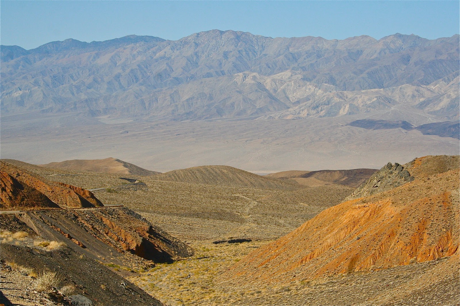
Mentioned earlier (500 Horsepower Reality) that I was out west this past spring. Rented an SUV (more on that later) and headed over to California for a few days - destination Lone Pine, Bishop and the eastern Sierras. Traveled Rt 190 from Las Vegas, via Death Valley. Pretty cool place - hung out for a while, but definitely need to return as a point of destination. A few photos:

First view of the valley heading from the east over the
Amargosa Mountain Range.
Rt 190 heading west toward Stovepipe Wells -
elevation around 200ft below sea level.
Mesquite Flat and the Stovepipe Wells Sand Dunes........
....Ditto.....
....Ditto.
Temperature at the Dunes was around 115 degrees (F). Ran into a young Japanese couple while hiking around. They stopped me and asked if I would snap a photo of the two of them together (using their camera). I noticed that the gal was barefoot, carrying her sandals. I also noticed a desert sidewinder track nearby (saw quite a few). I snapped off a few photos before mentioning the tracks, as well as that I'd bet the critters (snakes, spiders, lizards etc..) burrow into the sand during the day to escape the intense heat - probably not a good idea to roam barefoot. She immediately leaped in to guys arms. HA!

Traveling west over the Panamint Range toward
Panamint "Lake".
Rt 190 toward the east, traveling through Panamint (dry)
Lake.
West side of the Valley - Darwin Plateau, Father Crowley
Point and Rainbow Canyon - Panamint Lake Valley
beyond.
Rt 190 winding east from Darwin Plateau toward the
Panamint Lake Valley.

When returning later in the week I was traveling east through the Darwin Plateau area, over the steep mountain pass. I was winding my way down to the valley. I suddenly heard a deafening jet engine - sounded like it was on the roof of the SUV. I'm looking all around and up through the sun roof for this thing - wherever he was, he was right on my ass. I'm about ready for a missle or two to blow me off the road, when I round a sharp bend with a clean view of the valley floor, probably 3,000 feet of air below.
ZOOM!! - this F16 fighter jet comes blasting straight up out of the valley, probably 200 feet away - he does a steep bank turn with barrel roll to the east and shoots off like a rocket (or a jet) before I can even perceive what happened. I pulled off the road and grabbed the camera - hoping he would return. No luck. I'm sure his "maneuver" was on purpose - having some fun with the "dick" in the black SUV. Glad he's on our side. I'm sure he came from the China Lake Naval Weapons Center which is just to the south of the Valley.


Early November Snow

Here's some snow conditions today atop Chestnut Ridge - just off Sandy Flats Road. About four inches. The Laurel Ridge State Park cross country ski area showed about a foot on their webcam -  http://www.paccsa.org/lrwebcam. Will take another hurricane any day.


Didn't seem too good for any skiing, however - was pretty wet