(internet photo)
... the river is actually the boundary line between the two states - viewing north - Nevada to the west, Arizona east - the large body of water in the photo is 'Lake Meade'...
... 'Hoover Dam' from a few years earlier...
... lookin' downriver from the top of the dam - those large reinforced concrete piers rising from the canyon walls at the time are the under construction 'Hoover Dam Bypass Bridge' to reroute US 93 from it's current route over the dam...
... closer look at the pier structures...
... lookin' directly down the face of the dam - around 800 feet...
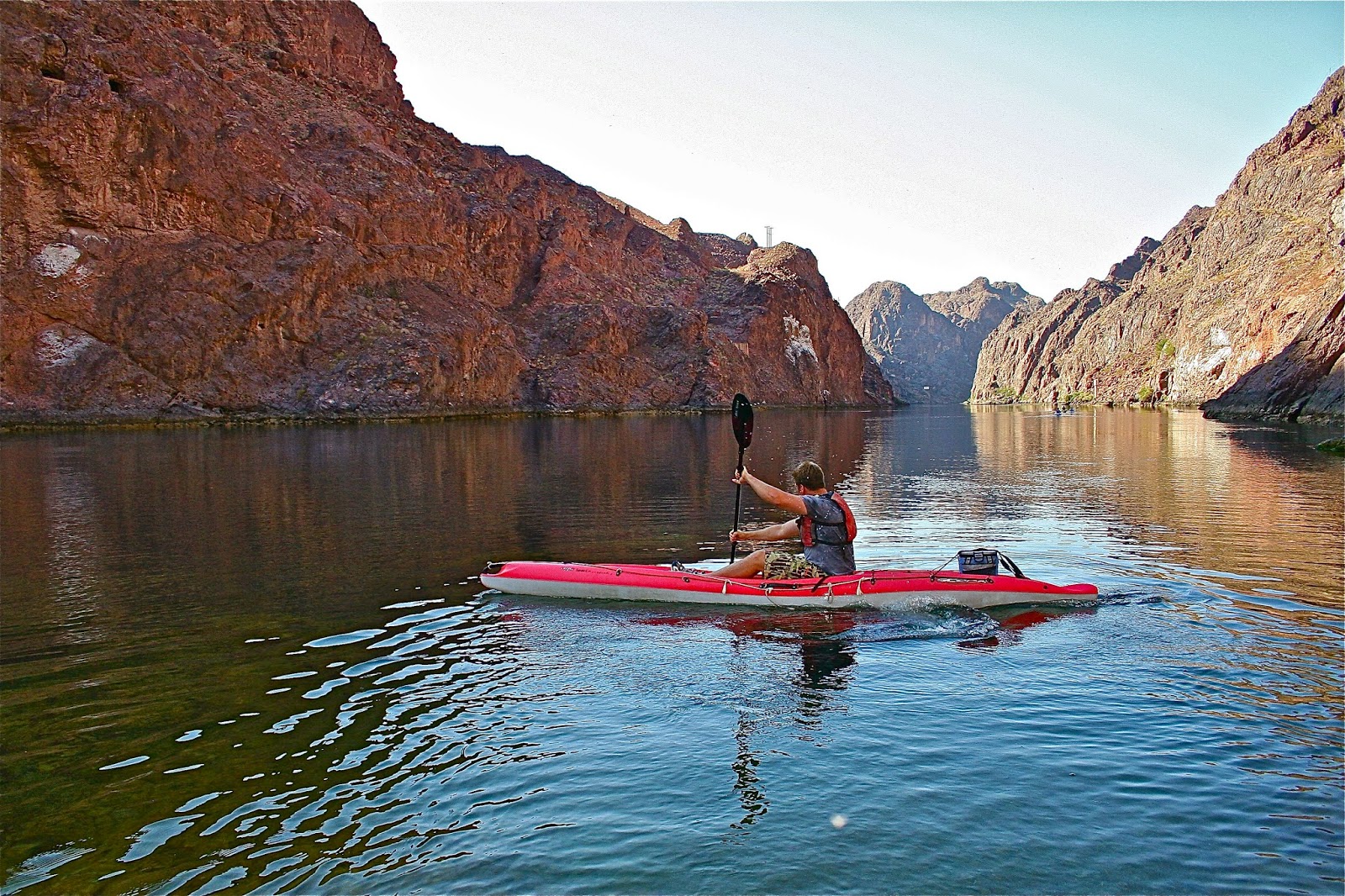
... a year or two later from river level - this is the put in for the 'Black Canyon' - makin' lots of progress on the bridge concrete arch - 'Hoover Dam' beyond - two fantastic feats of engineering in one photo - 'buddy' Matt paddlin'...
... we rented a couple flatwater kayaks and taxi shuttle from these guys, 'Desert Adventures', located in Boulder City, NV...
... pretty nice boats - pretty fast and track great - made by 'Bic' - had the same logo as the cigarette lighter - must be the same guys...
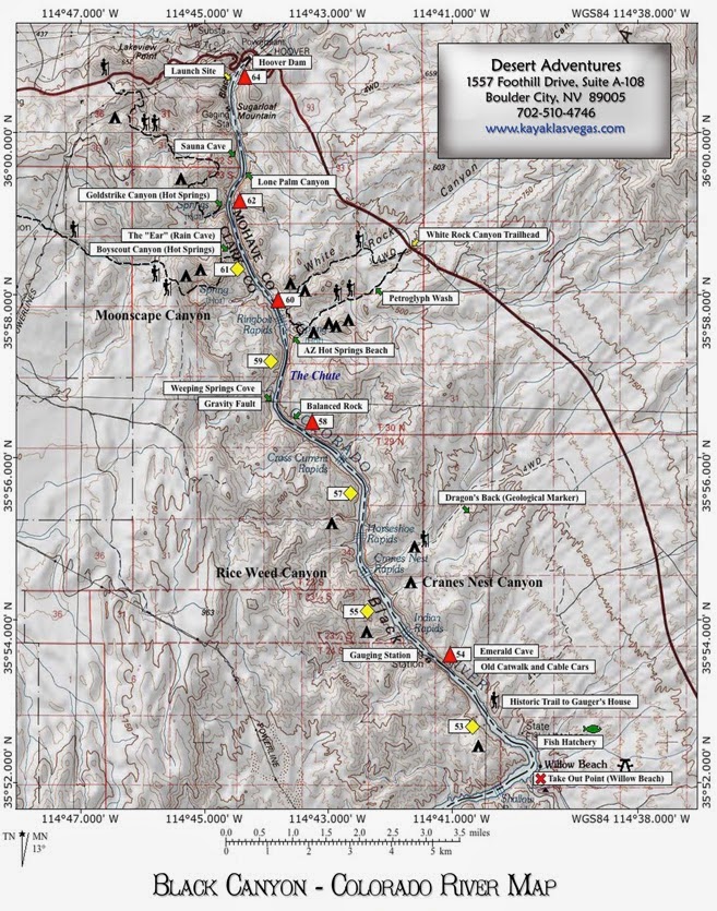
... here's a river map - as mentioned, around twelve miles to 'Willow Beach' - definite flatwater all the way with "nary a flow" - think that the river gradient drops less than a foot in the entire distance - may be wrong...
... but great water, scenery and weather throughout - the 'El Dorado Mountains' form the Nevada desert to the west, the 'Black Mountains of Arizona' the desert to the east, the 'Black Canyon of the Colorado' in between...
... we were gonna' do an overnight trip (was 'Memorial Day'), however, work the following day forced a one day trip - had to meet the "shuttle" by 4pm (7am start) - having never been on the river we weren't sure how to gauge our time - didn't want to arrive too early or too late - a guided trip rode the shuttle in with us - we figured that the river guides knew the correct pace - we figured that we'd "book on ahead" while they slowly unloaded and rigged and keep about a two mile distance - that way we'd have time to check out side canyons and trails - when we saw them coming 'round the bed, we'd book on ahead - they were pretty slow moving...
... the volcanic rock walls of the 'Black Canyon'...
... the trail into 'Boy Scout Canyon' - one of the several side attractions...
... lots of greenery and spring flowers along the way...
... heading into the canyon...
... some high vertical walls - the water is heated thermally...
... with several 'hot spring baths' along the way...
... the high canyon walls narrow to a slot in areas...
... stemming a slot to reach another hot spring...
... back on the river - some high peaks...
... lots of sandy beaches...
... lunch break - lookin' downriver...
... no one in sight - they really regulate this river well to keep the crowds down and keep it to a wilderness experience - 'Desert Adventures' told us that Memorial Day was their busiest day of the year...
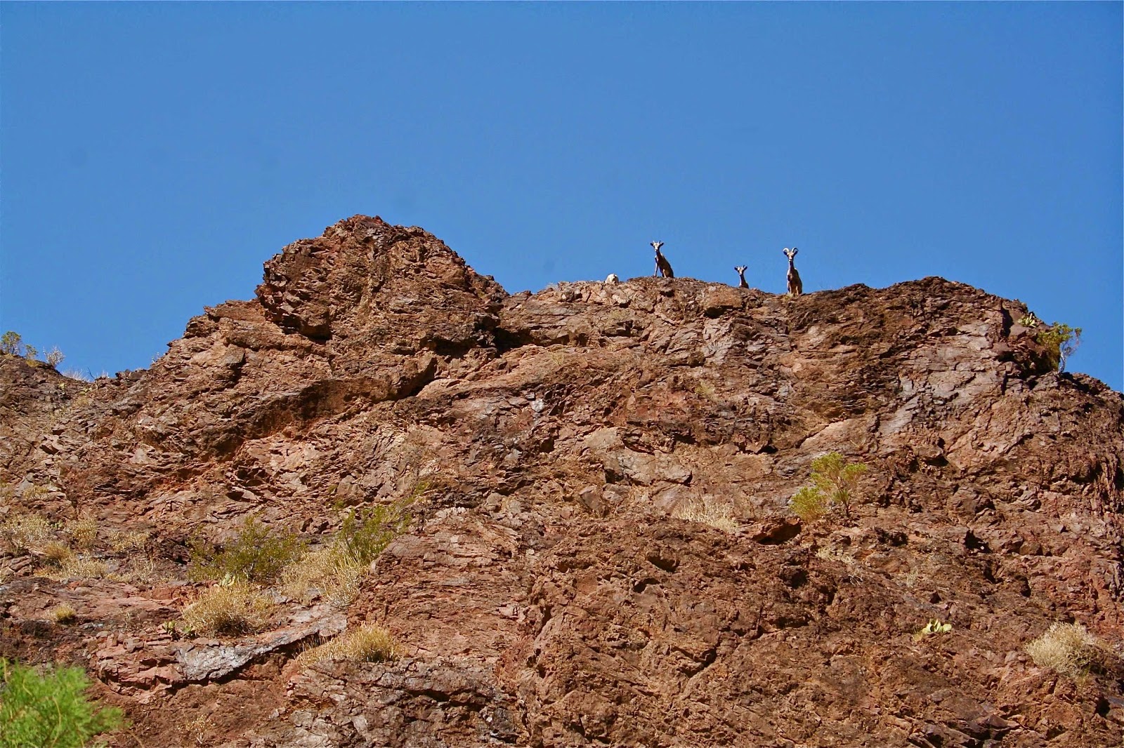
... not totally alone, however...
... a few 'Desert Bighorns' peering over the canyon rim...
... always take pride in being able to handle cold water, but this had to be the coldest water on the planet (and we're used to paddlin' eastern rivers in 30 degree temperatures) - you could only swim for a minute or two - and you're in the middle of the 'Mojave Desert' - guess because the water is released from 800 feet below the dam...
... a good indication of the scale of the landscape between these paddlers and the canyon wall...
... here as well...
... threw this guy a couple crackers and he followed us for at least two miles...
... until his girlfriend showed up...
... another sandy beach with an old cable car crossing...
... a pretty large lizard - plenty of those...
... emerging from the end of the 'Black Canyon' - open desert beyond - 'Willow Beach' right around the bend...
... a final look back upriver into the 'Black Canyon' - probably lookin' at all of the "traffic" on the river this "busy" day... Brilliant!... definitely wanna' go back and do it on an 'SUP' next time...


No comments:
Post a Comment