Sunday, March 31, 2013

Southern Red Rock Canyon (Western Trail Biking - Part 2)

That 'Specialized HardRock' trail bike (Ghostrider let me borrow it) was murder. Heavy with horrible balance. Good for flat trail riding, but about it (my opinion) - but, that's what it's built for. Could really have used the old 'Gary Fisher', but it was 3,000 miles away. Really wanted to try a few "rugged" desert trails I was checkin' out on the mapping. Considering the equipment options (none) and the high desert temperatures at the time, figured I'd stick with something easy and non-committing. Southern Red Rock Canyon sported some easy sounding single-track to the north of Highway 160 in the 'Cottonwood Valley' area - drove over to check it out...


... not bad, and not a soul around. Trail altitude ranged between El 3400ft to El 3900ft throughout probably 15 miles of interconnecting loops. The photo above is viewing north through Red Rock Canyon. 'Rainbow Mountain Range' (world class multi-pitch climbing) to the left. The low bands of contrasting tan and red rock near photo center are the 'Calico Hills' (lots of single-pitch, mostly 'sport climbing'). 'La Madre Wilderness Area' beyond. 'Blue Diamond Hills' to the right...


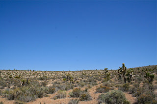
... viewing across a desert floor of spiney 'Yucca' plants and 'Desert Shrubs' toward 'Windy Peak' (L) and 'Black Velvet Peak' (R) with 'Mud Spring Canyon' between, as I recall (may be wrong)...


... typical area single-track - think that the "dry wash" to the right is 'Mud Springs'...


... a few 'Joshua Trees'. Lots of wildlife as well - say many 'Ground Squirrels', 'Desert JackRabbits' (a few big ones, too), 'Chuckwalla Lizards'... didn't get any photos, however...


... "ditto"...


... 'Joshua Tree'...


... 'Joshua Tree' seeds...


... some great riding...


... great weather and lots of blue sky - was gettin' pretty hot at this point, though - approaching 100 degrees F. As usual, miscalculated the water supply. Whoever first said that "Aw - the desert southwest isn't hot - it's a dry heat out there" is probably now a set of bleached bones lying out in the desert somewhere. Only ever hear that comment from someone back east - it gets f#n HOT!...


... this photo speaks for itself...


... most of the established climbing occurs north of these peaks within the canyon on the 'Sandstone Bluffs' between 'First Creek' and 'North Peak'. Is mostly solid and very competent. Lightweight and porous 'Aztec Sandstone'. That's a prickly 'Cholla Cactus' in the foreground...


... man, too hot today...screw this bike...wouldn't catch the 'Duke' or 'Clint' on one - gimme' a horse and mule next time....

Saturday, March 30, 2013

Ghostrider (Western Trail Biking - Part 1)

Was on trip out west in 2009 (Las Vegas, Nevada) and had the opportunity to do some trail riding with the mysterious, ephemeral 'Ghostrider'. He heard that I was in town, and immediately contacted me. Ghostrider only communicates through dreams - and then only to those in a deep, inebriated induced slumber. He suggested a moderate ride named the 'Bristlecone Trail' located within the Spring Mountains/Mt Charleston area north of Vegas - a frequent "haunt". At 6 miles in length the trail ascends around 1100ft in elevation, at an altitude ranging around 8100ft to 9200ft in an alpine forest in 'Lee Canyon'. I accepted immediately....


... met Ghostrider early at the lower trailhead. Said that all his "friends" called him 'GR' for short. This is GR's 'Specialized' dirt bike - not a top-of-the-line model by far, but was the best he could do at short notice. I tried it out - pretty heavy weight-wise and the frame slightly taller than what I'm used to. We made quick work of the lower three miles along double-track 'Scout Canyon Road', arriving at the spur with 'Bonanza Trail' and 'Bristlecone Trail'....


... a short break to admire some 'Indian Paintbrush' and sip some water (GR requires neither mortal need - water nor food)...


... and we continued along the upper trail...


.... GR leading the way...


... GR workin' me out - he can ride!...


... look at 'em go!!...


... started to get a bit technical - GR's specialty - mine as well - go GR, GO!!...


... didn't want to say anything, but he was smokin' me on that last section - was glad when he finally stopped to check out the view...


... didn't last long, though, and we're rollin'. The Spring Mountains are formed from thrust marine limestone - sharp as hell - like ridin' on a coral reef - wouldn't want to take a good wipeout on that stuff - GR even paused before descending this section...


... we're crankin' steadily above EL 9000ft - the far ridge line is Mt Charleston peak, around El 12,000ft...


... pretty cool area...


... GR's rock-hopping skills were impeccable...


... as was his downhill - the man was brilliant... BRILLIANT!!!...


... one last short break - nice view of the Spring Mountains...


... and he's kickin' ass and shiftin' gears - all downhill from here...


... GONE!!! - he's dustin' me!!...


... about a mile and he's waitin' on me - said that this is as far as he goes. His visits to our world are short, and his time is up for now...


... bid him farewell and continued, alone, along the double-track and back to the car - 'Mummy Mountain' high above....
......So long Ghostrider, my friend - you are one bad-ass from beyond!!!

Friday, March 29, 2013

IronArm Angels

More muscle girls - check out their website for more information as well as a new hardcore gym, the 'Virtus Institute', located over in Greensburg, PA:


I don't think that they're "twistin' to the hits" with Richard Simmons over there....

Thursday, March 28, 2013

Layton Falls

Hey, it's the first full week of spring following another (almost) non-winter. Definitely another non-existent ice season (from talkin' to all the "people"). Makes a lot of sense to discuss some ice climbing.

The Layton Falls discussion last post got me thinkin', and I decided to search the 'archives vault' for some photos. Was one of the first local areas we found with some consistently fat vertical ice (when in) and better yet, an easy top-out, which a lot of time was the crux of the climbs back then using the tools of the day, possessing minimal experience and thinking of blowing backwards off the top of the route, potentially upside-down, onto an ice screw.

The area is what it is - Layton Falls. The only climb there, nowdays. Probably Grade 3+, depending upon conditions. Maybe 50ft tall. Used to be three vertical streaks along the wall to the right ('The Three Sisters') that were top-roped. Easily Grade 4+ or harder nowdays. They were very narrow and difficult to distribute your weight across - most of the moves were a "barn door". They timbered the woods above the falls years ago, cutting a few skid roads which re-directed the water seepage to the wall - the 'Sisters' never really formed after that. The main falls are formed by a small tributary stream to the 'Yough River' that cascades down the hillside.The area is not much interest to anyone nowdays. Is a good place to learn/practice leading skills, though.  The falls get very "fat" in a good year. Zero "scare factor".

Always preferred the "frontier" other than established areas when possible. Never was crazy about "guide books". Own a million of 'em, but will always be more fun doin' your own thing other than following others. Good for identifying what hasn't been done, though. Subsequently, was always out "exploring". Before construction of the 'Yough River Bike Trail' (YRT) on the opposite side of the river, ya' used to be able to drive the old railroad bed from 'Dickerson Run' to 'Layton'. There are 2-3 pretty good Grade 2+ seeps, flows and gullies, each several hundred feet in length, each with a few short vertical drops over rock ledges, along the hillside flanking the river. Used to hit those one-by-one and finish the day at Layton Falls. Would be an all day ski-excursion now, no vehicles permitted, and you would have to shuttle two vehicles. Not worth the effort, in my opinion. If I get around to it (and can remember their exact locations), I'll put them on an map and post 'em.

Here's a few photos...


... the Falls...


... climbing, around 1987...


... that's former SWPA climber Glen Thomas above (1990). Note the old 'Forrest' positive-curve ice tools and flexible lace-on crampons. Those things were real "calf-burners" on vertical ice. The new and improved rigid 'Lowe Footfangs' which came out around that time (see the previous photo) were a vast improvement, as were reverse-curve picks...


... here's SWPA climber Tim Anderson toppin' out, around 2001. Tools nowdays change yearly and most are eventually considered obsolete within a matter of a few seasons...


... climbers just get older and slower...


... here's a photo (probably late February, 1986) of the falls just after the upper section collapsed, just missing the climbers standing directly below. Bad conditions that day and warm. Had done a single lap, each pick placement breaching an 18 inch water spout (note the hollow column on the left). "What the hell - probably last day of the year - one more lap and then we're out of here".... Crack!! - here comes the whole upper section - big as the Subaru we were drivin' - headin' straight for our heads - don't even remember each of us diving out of the way... almost as "spectacular" as Tim's episode on the 'Sick-le' a few years back (and we got that one on video!)... hey, one of the 'Sisters' visible to the right...


... here's a final shot of one of the aforementioned low angled flows opposite the river. This is actually a pretty cool climb. The photo doesn't do the angle or length justice. This is the just off the second pitch - probably about 100ft to the vertical finish above, which is about 20ft in height. Probably about a 200ft flow altogether. Excellent beginner-intermediate stuff and gear/ropework practice. Note the high-tech clothing, plastic 'Raichle' boots and earlier mentioned 'Footfangs'. This one is strange, however. Found and climbed it one year, returned the next year, same temperature/weather conditions - nothing there. Came back a few years later - there it is again (?)
(picture this in full conditions - about a foot of snow all about and a raging blizzard - first time conditions and excellent!!)....

Final note: Layton Falls is on private property. The owner is a pretty good guy and party-er. He actually built a pretty nice set of stairs down to the falls along with a wooden 'gazebo' in the stream gully. Guess it's all still there - haven't been there in years. If you visit take along a few beers and offer him one if you see him and you'll do OK....

.... almost forgot... of interest, the town of Layton was used as a location in the movie 'Silence of the Lambs'. If you park along the railroad tracks in town, don't remember exactly, but think it is the third yellow house to the west along Layton Road - is where the "psycho" lived and kept chicks in a pit he dug in the basement - is a standard feature on home construction in 'Fayette County'. They also filmed some exteriors along Layton Road - driving through the single lane roadway tunnel and across the bridge over the 'Yough River'.  

Sunday, March 24, 2013

A Useful Map - Updated

Updated the Geologic Map to include all the quarries and surface mines as identified on the  'Coal and Surface Structure Map of Fayette County, Pennsylvania' (1938), which was a companion map to the set. Was a bit time consuming, but the color annotations work well with the color Loyalhanna Limestone  crop lines. I checked it twice, and am sure I got them all - they were numbered up to around 325 total. I will update as/if missed ones are found. 

The quarry locations will be of interest to ice climbers. As mentioned, all the best and tallest ice forms at the abandoned Loylahanna Limestone quarries. I located most of them as landmarks on the map. I also included Layton Falls, which is located at an old sandstone quarry. There is supposedly a small mine opening there, which I suspect is an old clay mine. I was never there in warmer weather when the mine wasn't frozen over, so I don't know, and may be wrong about that. We were climbing there one very cold winter day and noticed a plume of "steam" rising from the hillside on the opposite side of the river - obviously some underground opening. We went down the next weekend to investigate  - was before the Yough River Trail, you could drive the whole way down. We hiked up the hillside and discovered a few vertical air shafts - looked just like something out of the old 'Time Machine' movie - looking down in, half expected to encounter some hairy cave creature climbing to the surface. Found a horizontal entrance, and walked inside for a look around. Was an old clay mine and pretty cool. As I recall the mine wasn't very tall - under six feet and we had to stoop most of the time. Was still an old mine buggy railway throughout. Thats why I figure that the falls may have been an old clay mine as well.

Anyway - don't think that I would waste my time checking out anything west of 'Chestnut Ridge', but ya' never know. Many old quarries along 'Laure Hill' according to the map - who knows, may be another 'Confluence Crag' among 'em. If anyone does any "exploring", I'd be interested to hear what ya' find. Won't hold my breath waiting, though.

The revised map:

Sunday, March 17, 2013

A Useful Map

Was doing some research for a project at work a few years back and came across this pretty good 'Geologic Map of Fayette County, Pennsylvania' (1938). The original map was typically annotated and color-coded for identifying geologic formations. I made two copies - one color and one black & white. I also digitized the black & white copy as PDF, TIFF and JPG files.

Lots of good things about this map. The best is that they used the Loyalhanna Limestone as a marker bed, with 100ft structure contours profiling the base of the Loyalhanna Limestone formation. What's so good about that?

1- Very useful for cavers. All the major caverns in SWPA are formed in the Loyalhanna Limestone formation. Anyone out searching for any undiscovered cave openings in limestone rock outcrops or near surface sinks or sumps pretty much have a roadmap for locating good areas to investigate.

2- Practically all of the climbable rock in SWPA consists of sandstone cliffs and large blocks of the Mauch Chunk and Pottsville geologic formations, with the Mauch Chunk bearing right atop the Loyalhanna Limestone - all identified on the map. A useful tool for locating potential unexplored climbing.

3- The best ice climbing in SWPA occurs at abandoned Loyalhanna Limestone quarries. There was also a companion map to this one annotated with all (which is many) of the quarry locations in the county, probably 95% abandoned at this day and age (1938 map, remember). I will post this map as well as soon as I annotate it for easier reference.

Here's the map:
I colorized the cropline of the Loyalhanna Limestone in red (the above is a JPG image). The Mauch Chunk formation is identified by tight-knit diagonal lines (see the map sidebar for symbols and descriptions). I added a few known landmarks that occur in the Loyalhanna (wouldn't it be cool if a cave system linked cross-county,  from Laurel Caverns to across the Yough from Opperman Cave) for orientation - the map is highly accurate.

Yea, the above image is pretty useless. That's why anyone wishing a copy can simply email a request to me and I will forward to you a PDF, TIFF and JPG image, free of charge. All images enlarge to pretty good (perfect) resolution - good for cropping enlarged sections of choice for printing. The original map size is 38"x 50". I can have copies of those available as well, but I will have to charge $15/copy (includes mailing). To all the cheap SOB's whose lower jaw just dropped, take note that 'Kinkos' gave me a price of $55/each to scan and copy the original (which I had earlier simply colorized with a blue pencil) - that's why I decided to digitize a copy and colorize it by computer.

The annotated landmarks won't be included on the copies (unless requested). Speaking of which - for those who don't know (not a Yough River paddler), the Ledges are just that - a small jutting limestone "bluff" formed where the Loyalhanna formation dips below (and under) the Youghiogheny River. I could dig up some photos somewhere with much searching. Easier for me, if you have a copy of Tim Palmer's book, 'Youghiogheny', there's a photo in there.

Interesting final note regarding the Ledges. Along the eastern bank of the river, opposite the Ledges, there's some interesting, wide vertical "fissures" in the Limestone. However, they drop below the river level. Additionally, one very hot summer afternoon, was paddling past the Ledges and there was a foggy mist wafting across the river (from the Ledges direction) that had a subterranean, cavern-like odor as paddling through it. Another time, encountered a large wood rat (a noted cave dweller) scampering along a rock shelf of the Ledges. Always meant to, but never spent any time investigating. Is easily accessible from the 'Yough River Trail - after about a six mile bike ride from the 'Wheeler Bottom' trail parking (about a mile south of 'Camp Carmel'), it would then be a short jaunt through the woods.

Sunday, March 10, 2013

The Tree...(aka: a Polaroid moment)...

Was searchin' the "archives" and found a few old 'Polaroids' - original "instamatic" type camera - popular at the time - originally marketed as a 'Swinger' back in the 60's - good tv commercial - "hot babe" in bikini strollin' away down some Southern California beach - close up on a 'Swinger' at the hip, doin' its thing (http://www.youtube.com/watch?v=h7k2uwJmwxo) - I think the chick is the actress Ali McGraw - pretty sharp none-the-less, snappy tune... and only $19.95!...


... I bet not many remembers this... long gone... probably the only photo in existence... nice shade tree at the top of 'Casparis Point'... someone set it on fire years ago and it toppled - was old, hollow and dry at the end - still no excuse...


..."learn't" to rappel off that old tree - armed with Royal Robbins 'Basic Rockcraft', 150ft/11mm Bluewater rope and enough ovals to create a 'carabiner brake', as described by Royal... 


... sweatin' like a...... anyway, hope you're right, Royal - about a 100ft splatter (not a "lightweight" at the time - 230+ and "buff") - worked like a charm - by the way, the right side of that point was also a decent place to practice gear placement...


... Ha!.. here's another one - who's this chick unroped at 'Opperman Cave' - got to the top and was afraid to downclimb - told her don't do it to begin with - made it safely back down - all the way I'm braced to field a "fly ball" (ha-ha)....


...one more... Westmoreland County Community College (WCCC) used to offer some pretty cool courses - here we are in 'Hot Air Balloon' class - that's course instructor and master balloonist John Addison's 'Raven' balloon anchored to the school grounds during a tethered instruction "flight" - John and I aboard in the basket... he used to smoke some pretty good cigars... was a few hundred bucks away from pursuing a pilots license and purchasing a balloon - if it wasn't for all the necessary (early morning) ground support, would have one... by the way, Fred Gunter/Exkursion Outfitters (http://www.exkursion.com/) used to conduct a climbing course there, as well.   

Saturday, March 2, 2013

Lost Fiesta Cavern [aka: WB Ice Cave] - (Caving Part 2)

We used to rock climb occasionally at a small Sandstone crag located in the Dunbar Mountains, on the opposite side of the "Morgan Run Hollow" (as I was corrected) from Kraylick Rocks. Around January 1995 a buddy (Ken Welsh) and I were out winter hiking in the area, and had stopped to take a break at the main "wall" - is tall (for SWPA, maybe 40ft), broken and severely overhanging - never really messed around on it for obvious reasons. While hanging around, we hear a lot of water dripping/flowing, and find that the sound is coming from inside the wall...?  We investigate several horizontal cracks and fissures in the wall face, and sure enough, there's water draining behind the wall into what appears to be a large chamber, judging from the reverb. We found a crawl opening at the base of the wall - however, it was too small to squeeze through at the time. We decided to return the following week with some digging tools.

We're back the following Saturday with tools and lights and some help. A bit of digging to widen the crawl, and we're in. Found a large chamber, and it was pretty cool - water flowing through cracks in the ceiling had formed a line of dangling ice daggers, at most maybe 5 to 8 feet in length, with a solid ice column from ceiling to floor, maybe 25ft in height, located at the south end of the chamber. The floor was also a sheet of thick ice  We were pretty stoked. The following visit we discovered another entrance, this one through a short climb and crawl accessed from a large 'shelter' formed at the north inside corner of the wall. This led to an "upper tier" that also formed a small ledge that ran the length of the back wall. This access must also have been the entrance for many critters - we found several large nests and piles of assorted nutshells. Visits in warmer months also revealed many 'cave crickets' and large spiders. There is also some type of miniature blue and purple mushrooms which grow on the walls. Through the years we also found that the cave functions as a natural freezer - we have found ice, particularly on the floor, well into late April (extra cold winter, naturally). Pretty nice.

As far as we know, the place had been unknown. Rob (Goodman) inquired into the local caving 'grotto', of which he and a few other buddies were members, and they had no knowledge of the place. Coincidentally, at the time the grotto had just published a book on all the known SWPA sandstone caves and shelters - no mention there. Rob stated that the find was probably the largest sandstone cave discovery yet - just saying....


....heres a shot of the exterior wall. That's Ken (Welsh) added for scale - he's standing in front of the "dug crawl", just after completion. Ken's another local hardcore guy who is always an asset to have along. Note the horizontal cracks in the rock bedding. The interior chamber pretty much runs the length of the wall....


...here's the location. Park at the new PA State Gameland parking area, just over the new bridge over Morgan Run (just past the iron furnace). Take the logging trail opposite the parking area uphill for a about 0.35 miles - a short bushwack due east thru the woods will put you right on top the cliff...


...here's a map of the cave itself. Is not to scale. Total length of the room is estimated at around 70 feet...


... that's Bill (Fiesta) sitting at the entrance to the 'shelter'. We hiked up there last Sunday with the intent to get some interior photos for this post. All the many visits there over the years, and other than shooting a bit of video, had never taken any "stills" from inside. None this day either - the entrance to the crawl from inside the shelter was blocked by a thick curtain of ice. We didn't bring any tools to bust through, either - wasn't anticipated - never encountered that before...


... here's Bill and the interior of the shelter. The floor was solid ice, as well. I'll bet the cave itself is currently formed pretty nice, considering this photo. Will update this post with some additional photos if  we make it back up there in the near future...


... lastly (is that a word?), here's an old photo depicting some of the rock climbing conditions on the surrounding walls and boulders.  The area has some pretty decent climbing.