Sunday, April 21, 2013

Bouldering, the Ridge and the People in the Woods (Part 1)

It's that time of year and a few people inquired as to 'bouldering' around here - here's some information and a quick tour....

We photographed the 'Bouldering' video, that's been up on the website for a while now, way back in 1998, with editing completed the following year. Again, shooting on 16mm motion picture film (Eastman 7246). Was pretty much outdated from the get go - the practice of 'bouldering' had pretty much exploded around the year 2000, with tons of climbers, lots of exposure in the climbing 'media' and all the gear/clothing manufacturers producing more 'bouldering specific' paraphernalia (rock shoes, crash pads...) than you could "shake a stick at". New rating systems were developed to address the many "super difficult" problems that were being "put up"- no more B1 (you can do it), B2 (you can't do it) and B3 (you can do it but no one else can - however, if repeated, reverts to B2..? - so theoretically, you had to do a B3 (harder) before you could do a B2 (easier) - contrived logic, none-the less. Bouldering"V-Grades" made a lot more sense, basically correspondent to the "free climbing" Grade 5 level, with "easy" beginning at around 5.10.

Other than the 'corny dialog' - the film didn't turn out too bad. Considering that we were shooting film (expensive), we stuck mainly to stuff we had "wired" - no budget for "re-takes". Still got in a lot of good "problems". The boulder "locations" are from everywhere - Fish Rocks, Mojo, Yough River, High Rocks, the infamous 'Workout Boulder', Casparis and The Ridge, a few 'One Outs' (new term recently heard - like it).. Probably the best SWPA area by far are the flanking slopes of this 'knob' located in the 'Casparis' area of 'Chestnut Ridge'.....

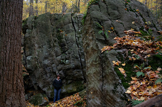
.... had bouldered there on and off since the mid-'80's. However, mostly rope-climbed at the 'Stairway to Heaven' area located at stones numbered 6 thru 11 and adjacent wall as indicated on the above map (significant locations have been numbered for later reference - the trail system was plotted using GPS co-ordinates). Hiked Tim Anderson through the place around 2006 and all he saw was a lot of potential. By the end of summer 2008 there had been 200+ new 'problems' established along with a "rustic" trail system....

... Tim and Laura - the energy behind it all...

... Rob Goodman, original "frontiersman", on top of the 'Uberman Block" (stone #9 on the map)... as well as bouldering, developed most of the roped climbing in the area ...

... long-time climbers Bob Rentka (stone #1)...

... and Carl Samples (near stone #1) also contributed big-time to the recent development...

... as did Matt Johns (stone #3) during several trips from Kentucky (Anderson Photo)...

... another "frontiersman", Matt Burnsworth with bodyguard - this boulder isn't identified on the map, is slightly further down the valley - he put up the route to the right which remained a "B3" for many years, with many attempts by quite a few good climbers - took Carl up there a few years back - he repeated it on his third try...

... speaking of which - there's much more in the area than mapped - the north ridge opposite the creek is an extension of the area - here's Bob and Carl on an unnamed block...

... and again on the nearby 'Biscuit Block'...

... this seldom visited crack is located at the small area near where "filtration plant" is annotated on the map (muscle girl Sarah standing in for scale)...

... back to the 'Ridge', Laura on FA of the 'Blunt Arete' (stone #3 - Anderson Photo)...

... Tim "dynamic" on the 'Power of Tang' (stone #3 - Anderson Photo)...

... Tim workin' Matt on the 'Wizard' (stone #5) - another "B3" per old standards -  there's a good segment showing Tim on the FA in the video 'People in the Woods' posted on the website...

... Laura on 'Two Hicks and a Chick' (stone #26)...

... Tim workin' the low roof 'Horizontal Latitude' (stone #21)...

... Tim on a difficult route on either the 'Fish' or 'Seneca Block' - forget what they called it (stone #4)...

... Bryce Dillinger (climbing) and Dave Lane on 'Hicks in the Thicket' (stone #22)...

... Joel Brady on a "project" down in the 'Wash' (near stone #15)...

... Carl on the 'Black Box' (stone #12)...

... Bob climbing with Carl - I even forget where this is at - is a maze of rock up there...

... steep slab in the 'Stairway to Heaven' area (stone #7) - Rob for scale...

... Tim on an old un-repeated steep and thin slab route (stone #2)... 

... I could go on forever - here's some final shots of the walls - Rob on a cool crack climb at the wall near stone #5...

... and doing some "gardening" at the 'Beginner Wall' (near stone #6) - don't let the name fool ya'...

... by the way - lots of good "cooling off" opportunities along the nearby 'Yough' if it gets too hot to climb - Matt, Laura and Tim hanging at a "secret beach"....

... a "wave goodbye"!

Sunday, April 7, 2013

Charleston Climbing and the High Desert

Lots of excellent climbing in the Spring Mountains - brush up on your 5.12+ before venturing out....

... this is the 'Hood' area just off the 'Canyon' trail, about a half mile from the trailhead...

... steep limestone - all bolt protected 'sport' climbing (I guess anything else isn't sporting)...

... nice view across the canyon...

... ran into this 'couple' - were "warming-up" on a 5.12 or two before heading into the "caves" for some .14's (?!!) - had a really cool dog tagging along - was a little older and was roaming about like he was raised there - thought he was a stray when I first ran into him - not the case - they had a whole area laid out for him - bed, bowl, bones - why are all these young "modern" climbers I run into such nice, affable people, and damn good athletes ta' boot... it's just like "have fun man and leave the place the way ya' found it, or better" -  remind me of a few others I know...

... another canyon view...

... one of the 'caves'...

... a peak inside - check out the many "draws" identifying the climbing...

... was late spring - some type of flowering cactus...

... couple other guys - only other people out that day.. think they're on a "Charleston 5.6" (I think the grade scale resets at 5.10 up there)...

... left the 'Hood' and drove up to 'Robber's Roost' - no one there - more horizontal stuff - probably 80ft distance out to that last "draw" in this "cave" - I was gonna check out the holds to the start to this route - couldn't find any - just some chalk marks...

... still some snow in the shadows - a miniature 'glacier'...

... relax - some walls there as well for easier 5.13 climbing...

... had to leave - headin' back down 'Highway 156' and the high desert - lookin' back at 'Mummy Mountain'...

... the high desert - coolest place on earth...

... ditto...

... some type of flowering desert shrub (I guess)... nice...

... they call it 'Mummy Mountain', "cause it looks like a 'mummy" in profile - looked at it for a year or two - "I don't see no mummy!" - was drivin' back at dusk one night, just turned south on I-95 off Highway 156, headin' back to 'Vegas' - flyin' back home tomorrow (boo-hoo!!) - took one last look back - "I'll be damn - that mountain up there looks just like a mummy!!"......HA!!!

Mummy Mountain

Speaking of 'Mummy Mountain', we did a pretty cool hike/scramble to the summit a few years back. Highly recommended. At 11,528ft elevation, it is the second highest peak in the 'Spring Mountains'. It's a solid 10 miles out and back (20 miles round trip) at a total elevation gain of 3,820 feet. Keep in mind that the highest point in PA, 'Mt. Davis', is El 3,213ft.

Stopped in the local 'gear shop' the day earlier to pick up a few items. Asked the guy workin' the shop about the 'route' - "Man, that's a long, steep hike - you guys better get at least a 4am start - if you want to make it back before dark (was currently 'Eastern Standard Time' hours) if you make it at all... considering your just off the plane from back east, you're gonna' have problems with the altitude!... you better take along plenty of water!"... and on and on... the only thing he left out was "yer gonna die!". He kind of talked me out of the 'venture' - didn't feel like having to rush things. Mentioned this to buddy 'Matt'. Didn't have anything else planned, so we figured we'd check it out anyway, for a later full scale trip the following spring. Planned on getting to the trailhead by 9am with 12 noon being the 'turning back' point. Was Thanksgiving Day and we wanted to later hit the 'MGM Casino' downtown for the 'turkey buffet'.

We hit the trailhead at 9am on the dot and headed out at our normal pace. Some great hiking through an alpine forest of fur, spruce and pine. Steep, but not as steep at all as anticipated (or "warned" at the shop). By 12 noon we're well above treeline and setting in an open field just above the ridge 'saddle' and staring at the summit cliffband of limestone rock. Can't be more than another half hour to the summit - what was that guy talkin' about? Here comes two other guys just off the summit. "Hey, how much further to the top?" "About a half hour" was the reply (?). We went for it - made the summit and hung out checking out the views 'till 1:30pm. We're back at the vehicle at 3:30pm on the dot. Total trip time 6-1/2 hours with about a 40 minute break at the top. At 5:30pm we're showered up and in line at the buffet.

Some photos - didn't take many on the way up as we didn't expect to make it - took most on the way
back down...

... the steep 'scree slope' ascending the ridge 'saddle' - pretty loose, was two steps up and one step back...

... lookin' back across the 'saddle'...

... at the top of one of the several hundred foot, east facing limestone walls...

... approaching the summit cliffband...

... a steep '3rd Class' break in the cliffband to access the summit...

... summit photo....

...summit viewing east - that's an observatory on the next ridge over - 'Las Vegas' off in the distance...

... summit viewing west toward California...

... here comes some guy (or girl) in a glider (photo center - just below the "lens flare") - the far ridge is Mt. Charleston...

... this section was a bit 'hairy' on the way back - not seeing any sun, a little steep (more so than indicated by the photo) and completely covered with a thin layer of 'verglas' ice - ya' actually had to 'glissade' on your 'butt' from just beyond the shadow line and hope ya' grab that big tree to stop...

... completely iced over and hairy as hell - and that's a several hundred foot vertical drop on the other side of those trees. The guys we ran into earlier said that they were turned back the previous two weekends because of icy conditions - they both had crampons with them this time. I eventually picked up a set of 'trail crampons' and keep them in my pack. A company called 'Hillsound' makes a real nice pair...

... back in the 'saddle' again...

... you could 'standing glissade' the scree slope - a lot of fun...

... descended several hundred feet in a matter of seconds - actually got movin' pretty fast - lots of limestone walls off in the distance...

... base of the scree slope and below treeline...

... pretty cool trough of springwater...

... back at the lower 'saddle' at El 9,390ft and intersection with the 'Canyon' and 'North Loop' trails - lookin' back at the 'Mummy' and massive limestone walls...

... subalpine zone...

... final approach descending the 'Canyon Trail' and the limestone walls buttressing 'Mt. Charleston... the buffet was excellent...