....start at the bottom of 'Casparis Hill' in South Connellsville, follow to 'Foleys Pond' - then north to 'Sandy Flats' - north/east to 'Sandy Flats Road' - east thru 'Hawkins Hollow' to Mt Tabor Road - south to 'Indian Creek' - follow Indian Creek (many swimming holes) to the Youghiogheny River - just west of the railroad trestle (bounce across the abandoned trestle for a bit of a thrill) - wade the Yough River south to 'Camp Carmel' (< 2ft on the Ohiopyle River Gauge is best) - thru the camp (expect some hassle from the "camp counselors" - good people, none the less - if they're there - good place to refill water bottles, they have an outdoor wellhead with water faucet) - jump on the Yough River Trail (YRT) - east/south a few hundred feet to gate - right thru gate - follow long uphill - past Kraylick Rocks then flats to 'Iron Furnace' - stay right then north/west to long uphill to 'Elk Rock' - right at intersection then west to the second - turn right to best single track downhill around (take a break to check out the Yough River overlook just before) - follow to the old 'timber mill' - stay right thru the woods - pick your way thru the single track - up hill then long downhill - when you run out of downhill, go left/south - follow to 'Cow Rock Road' ('frog pond' at intersection) - then northwest on 'Cow Rock Road' maybe 100ft - turn right (north) thru woods to steep technical downhill to YRT - then left/northwest back to ......
...e'nuff already!... about a 25 mile ride linking the east and west Yough River Gorge. Some serious elevation gain (for SWPA, maybe 1,800ft) capped by thee big hill climbs....here's a map.......
The red trail is 'main line'. Blue trails are links. Markers are just that - most are rock climbing locations.
Some photos (includes a few old prints) :
 |
A short, steep and technical hill climb
(Don't judge it from the photo)
(Matt) |
 |
Winter
(Howie) |
 |
| Goodman |
At the time, other than a set of "wheels", didn't go much for slick or fancy outdoor gear or "threads". Wasn't a whole lot available, anyway. Let this guy get away with it, though - sort of like sporting an earring or tattoo back in the days. If you could backup your "game", no one messed with ya'.
 |
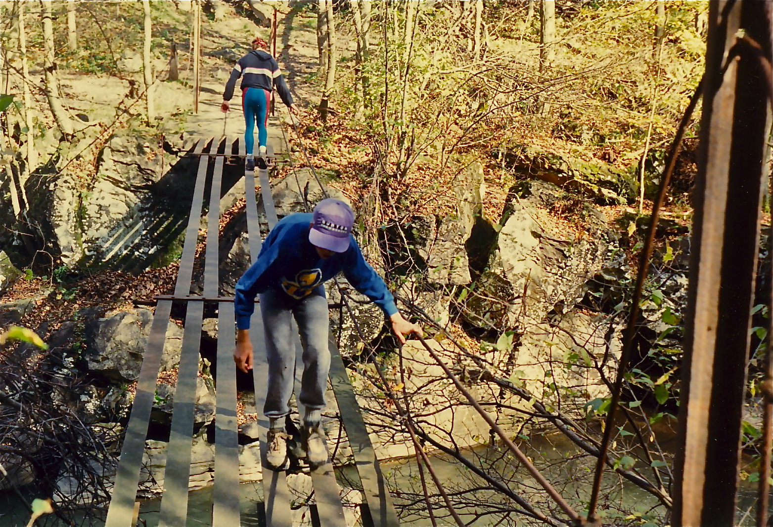
The old "footbridge" crossing Indian Creek
Just below 'Terminator' rapid
(Matt, Rob) |
 |
Overlooking the 'Yough Gorge' from the west
The 'Three Sisters' boulders seen in the river bend
'Opperman Mine' is the cliffband in the upper right |
 |
Steep single track descending from the Overlook
Doyle Tarwater riding
(Again, don't let the picture fool ya') |
 |
Some great singletrack
(Doyle again) |
 |
The 'Yough River' crossing - before departing, check the
'Ohiopyle' river gauge if not familiar with the flow - a little
difficult if the river is staging > 2ft
(Howie and Matt) |
 |
Rob atop one of the twin 'Pillars of
Hercules' at the 'Yough Gorge Crag' -
The 'Yough River' far below |
 |
| Rob takin' a break at 'Kraylick Rocks' |
Pretty much of everything on this ride and lots to view - giant boulders, cliff overlooks, waterfalls.... Watch out for timber rattlers and copperheads - and baby black bears during the season - ran into an angry mother once - and no matter what ya' think, mom isn't far away (and watching). Limited to the summer months because of the river crossing. Plenty of alternatives, regardless (see map). Would plan on at least a eight hour trip. You can leave a vehicle (or start from) the Yough River Trail parking in Connellsville or near the 'Wheeler Bottom' water plant as an alternative. Never tried to reverse the trail, and wouldn't want to attempt it - a few of the drops are steep and pretty technical and are not negotiable on return, unless on foot. Pays to be in top shape, as well. Took a small group of "experienced adventure racers" along once or twice and totally fried 'em (with lots of wipeouts on the slick, slippery rocks and fallen limbs - "f*k this" was a frequent comment). Personally haven't made the complete trip since probably 2000 (used to crank it 2-3 times a season), so no guarantees. I'm told that Indian Creek is now off limits with security patrols - someone is now running a campground up there - thats all I know of that. See the 'blue trail' on the map for a "bypass" (another steep downhill) that will take you to the lower section of the creek.
More to follow....


No comments:
Post a Comment